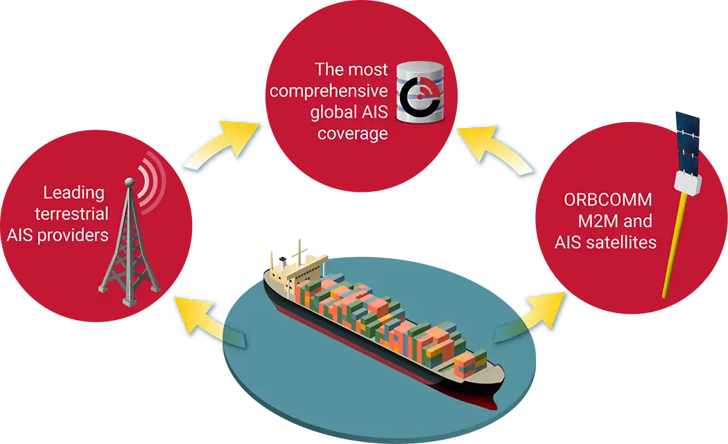
ORBCOMM is the global leader in Automatic Identification System (AIS) data services, used by ships and vessel traffic services for identification and location. Our AIS data delivers the most complete situational picture of global vessel activity.
A Single Source for AIS Data
Gain access to the most complete global AIS coverage—a one-stop shop for both satellite AIS data from our own constellation and terrestrial AIS from leading partners.
Unmatched AIS Reliability
Our next-generation satellites and robust ground infrastructure process 30 million messages daily from over 240,000 unique vessels.
Most Cost-Effective AIS
Enjoy AIS data plan pricing and flexibility that only an established and stable AIS data provider such as ORBCOMM can provide.
A Partner You Can Trust
Get only our flexible APIs and AIS data sets, without the hard upsell on other services. Plus, as our partner we won’t compete with you—we’ll empower you to succeed.
Versatile
Our AIS solutions are ideal for diverse applications such as search and rescue, surveillance and security, IUU fishing, environmental monitoring and more.
01 /
Daniel Acosta
President,
Founder and CEO, Grydd
…a tool to track data in near real time. We help our clients make better decisions by giving them access to all the pieces of the supply chain puzzle.
…a tool to track data in near real time. We help our clients make better decisions by giving them access to all the pieces of the supply chain puzzle.